A Quadrangle is a designated area defined by the United States Geological Survey. The Freeport Quadrangle is a 15 minute series map. These older series covered a large area of land between 15 minutes of geographic area both North to South and East to West. Since the Earth is a globe and the East to West boundaries narrow as you go North, these are not true squares, thus are named quadrangles. Modern Quadrangles are 7.5 minutes.
There are several Freeport quadrangles throughout the United States, so I should state that this is the Freeport, Pennsylvania 15 minute Quadrangle.
How long is a minute?
It depends on the direction. The Earth, divided up into 360 equal parts in all four cardinal directions, provides a system of location determination. Half a globe is 180 degrees. A degree divides up into 60 minutes.
The difference is between latitude and longitude. Latitude lines are parallel. These start at the equator and have spacing of roughly 69 (110 KM) miles apart. Longitude lines are not parallel. These connect at the North and South pole and space out equally over 360 degrees.
If you divide the 360 longitude lines up by the 24 hours in a day, you get 15 degrees per hour in a day (360 / 24 = 15). The sun travels perpendicular to the surface across 15 degrees per hour, no matter where you are on Earth. This relative speed is much faster near the Equator vs near the poles.
A 15 minute quadrangle has a height of 17.274 miles. To get a width measurement, we need to determine how far North we lie. In the Freeport, the top boundary is approximately 13.119 miles and the bottom is 13.168 miles. The entire quadrangle is 227 square miles, approximate.
| Dimension | Full Degree Length | 15 Minute Length |
|---|---|---|
| East to West at 40° 45′ | 52.476 mi | 13.119 mi |
| East to West at 40° 30′ | 52.672 mi | 13.168 mi |
| North 40° 45′ to South 40° 30′ | 69.096 mi | 17.274 mi |
These measurements will be exactly the same for quadrangles East or West.
Quadrangles are far from absolute
Since the length of a quadrangle varies from East to West, the general area of land contained in one becomes smaller as you move North. The largest possible quadrangles border the Equator, meanwhile the smallest lie adjacent to the North or South pole.
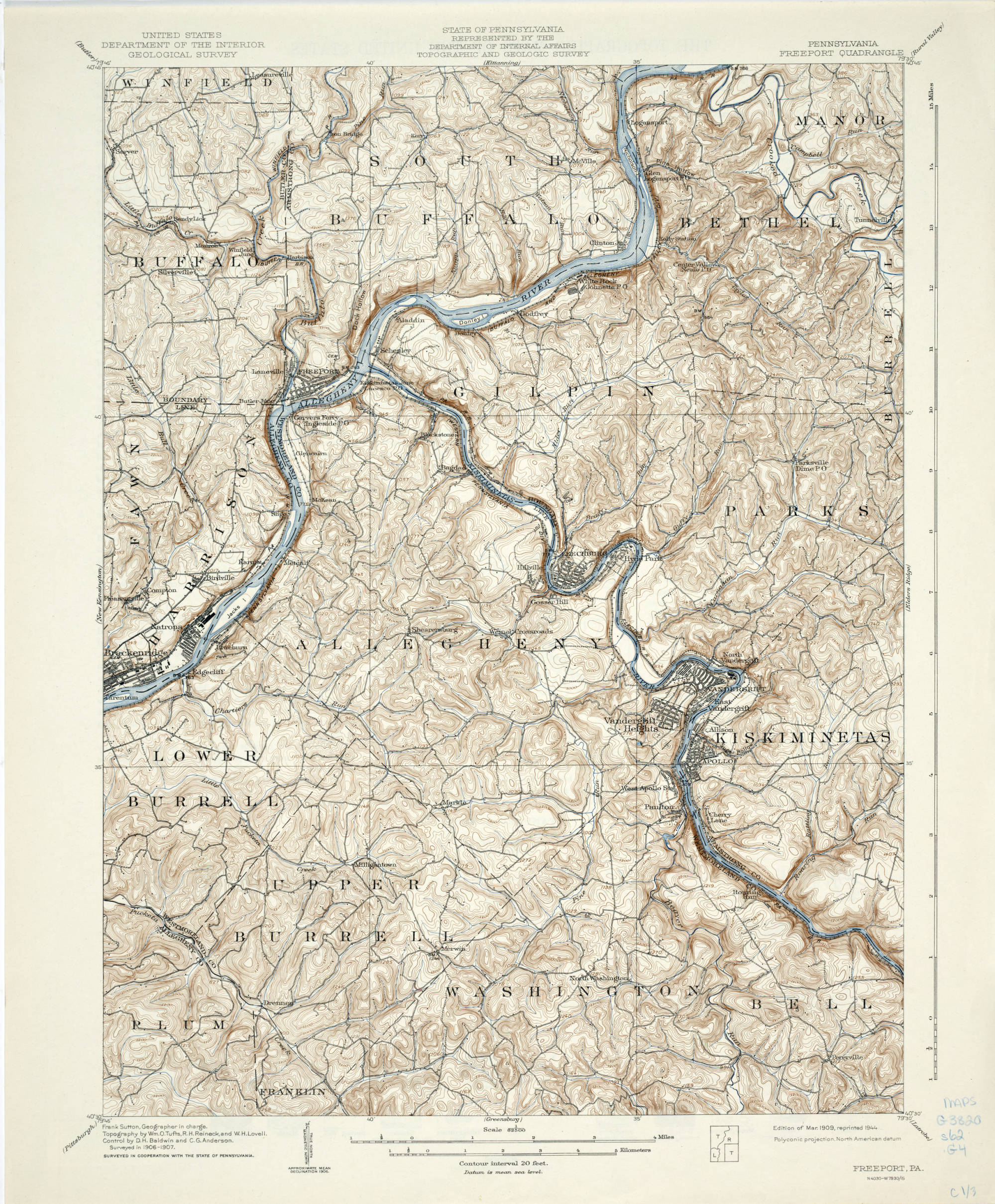
U.S. Geologic Survey, 15 minute series map, Scale 1:62,500
Neighboring Quadrangles
There are 8 different quadrangles that surround the Freeport, Pennsylvania quad. They are arranged as follows.
Butler | Kittanning | Rural Valley |
New Kensington | Freeport | Elder’s Ridge |
Pittsburgh | Greensburg | Latrobe |
H. Herbert Hughes 1933 Publication
The most comprehensive publication on the Freeport Quadrangle is a 272 page report (over 100 are drill records and charts) written by H. Herbert Hughes. It is part of the Fourth Series of the Pennsylvania Geological Survey. The field work for the survey was performed between 1927 and 1928. This was during the later prohibition years in the United States (1920-1933). Freeport, the town the Quadrangle is named for, suffered during prohibition. The Guckenheimer distillery was the primary industry before the 18th amendment took effect.
Hughes noted that several modern highways were recently built in the area.
References for the Freeport Quadrangle
- Hughes, H.H, 1933, No. 36 Freeport Quadrangle, Topographical and Geologic Atlas of Pennsylvania
- Length Of A Degree Of Latitude And Longitude Calculator, CSG Network
- Freeport quadrangle, Pennsylvania : 15 minute series (topographic), Pennsylvania State University. Libraries, Item ID: 25759