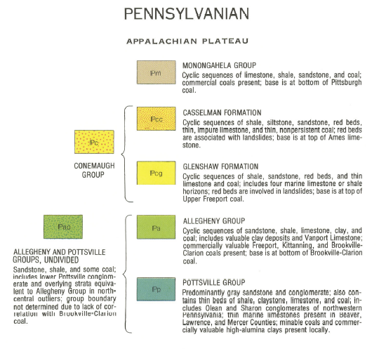
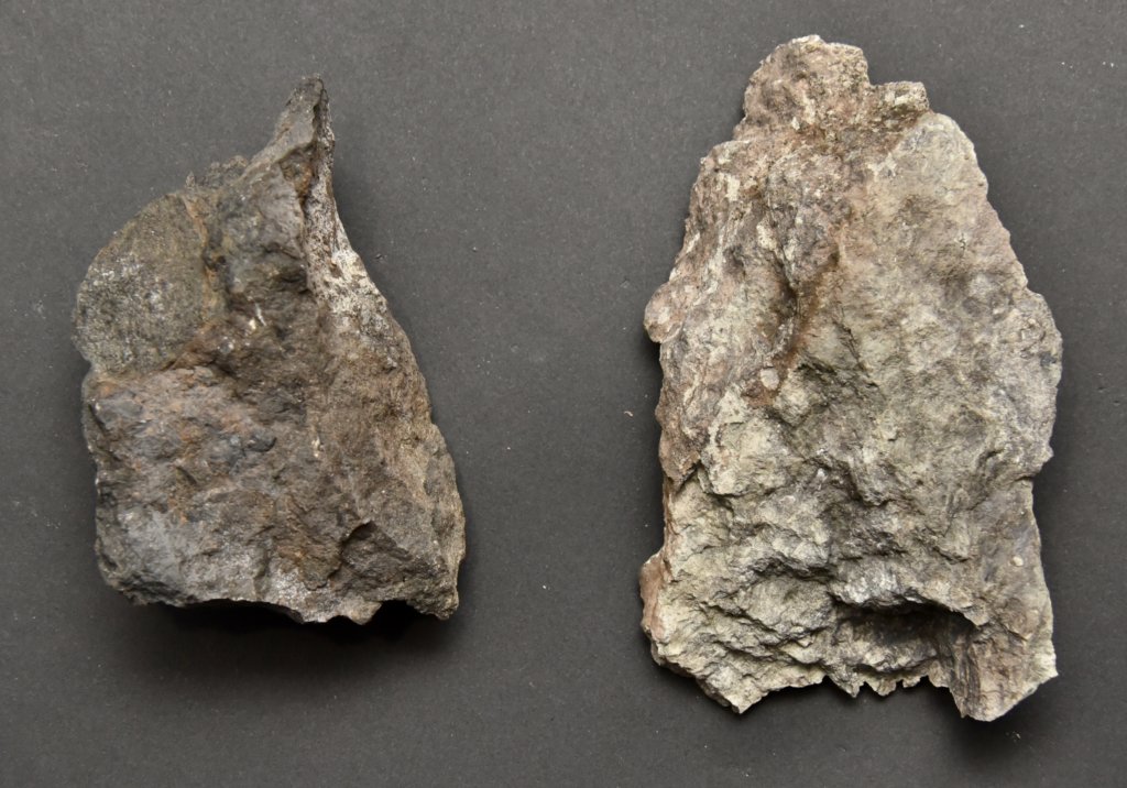
The Ames Limestone (Andrews, 1873) is the boundary and limestone stratum between the Casselman and Glenshaw Formations within the Conemaugh Group. This limestone can be found throughout Western Pennsylvanian, Eastern Ohio, and northwestern West Virginia. It is a laterally extensive stratum that contains what many call the most fossiliferous in Western Pennsylvania. Being limestone, the fossils within are mainly marine. An exception to this would be a land-based creature or plant falling into the sea and being buried, which is rare.
Geologic Age
The Upper Freeport coal bed is the lower boundary of the Glenshaw Formation, while the Ames Limestone is the upper boundary. The Ames marks the boundary between the younger Gzhelian, the last stage in the Upper Pennsylvanian, and the older Kasimovian. While many older papers refer to names such as the Missourian or Virgilian Stages, the International Commission on Stratigraphy uses standard global names.
| Global Stage | Age | Time Represented |
|---|---|---|
| Gzhelian | 4.8 MY | 298.9 – 303.7 MYA |
| Kasimovian | 3.3 MY | 303.7 – 307.0 MYA |
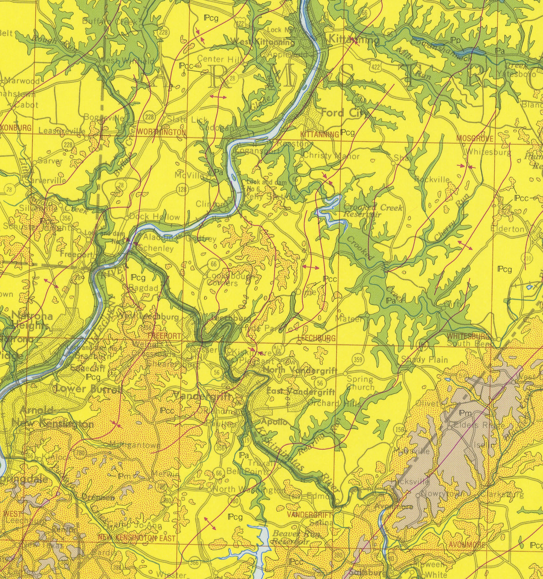
The map below shows Ames as the yellow-to-orange merge point. Published in 1980, this map is by the Commonwealth of Pennsylvania Department of Environmental Resources. One interesting detail about this map is that the freeway portion of PA 28 terminates shortly after passing the Freeport area. This shows the map’s age; it was published about 40 years ago.
The Ames preserves fossils dating back to the Carboniferous Period. More specifically, the late Pennsylvanian.
Here is a map of the Casselman Formation embedded on Google Maps.
In a 1933 report, H.H. Hughes noted that the Ames Limestone was nearly 30 inches thick near Perrysville, which I believe was in Bell Township, southeast of Vandergrift. In the Plum-Lower Burrell area, it was 16-35 inches thick and was utterly absent at two drill sites. Fragments found in the Northern part of the Freeport Quadrangle, South Buffalo Township, were 3 to 4 inches thick.
Compared to the Brush Creek Limestone
The Brush Creek Limestone has a much darker matrix, likely due to a more anoxic environment during the sea’s invasion of the land. A lack of oxygen means more of the biomass from the living creatures above doesn’t break down at the bottom of the sea. The Brush Creek is an older limestone deposit, separating the two ancient seas by approximately 2.3 million years.
Exploring Ames Limestone
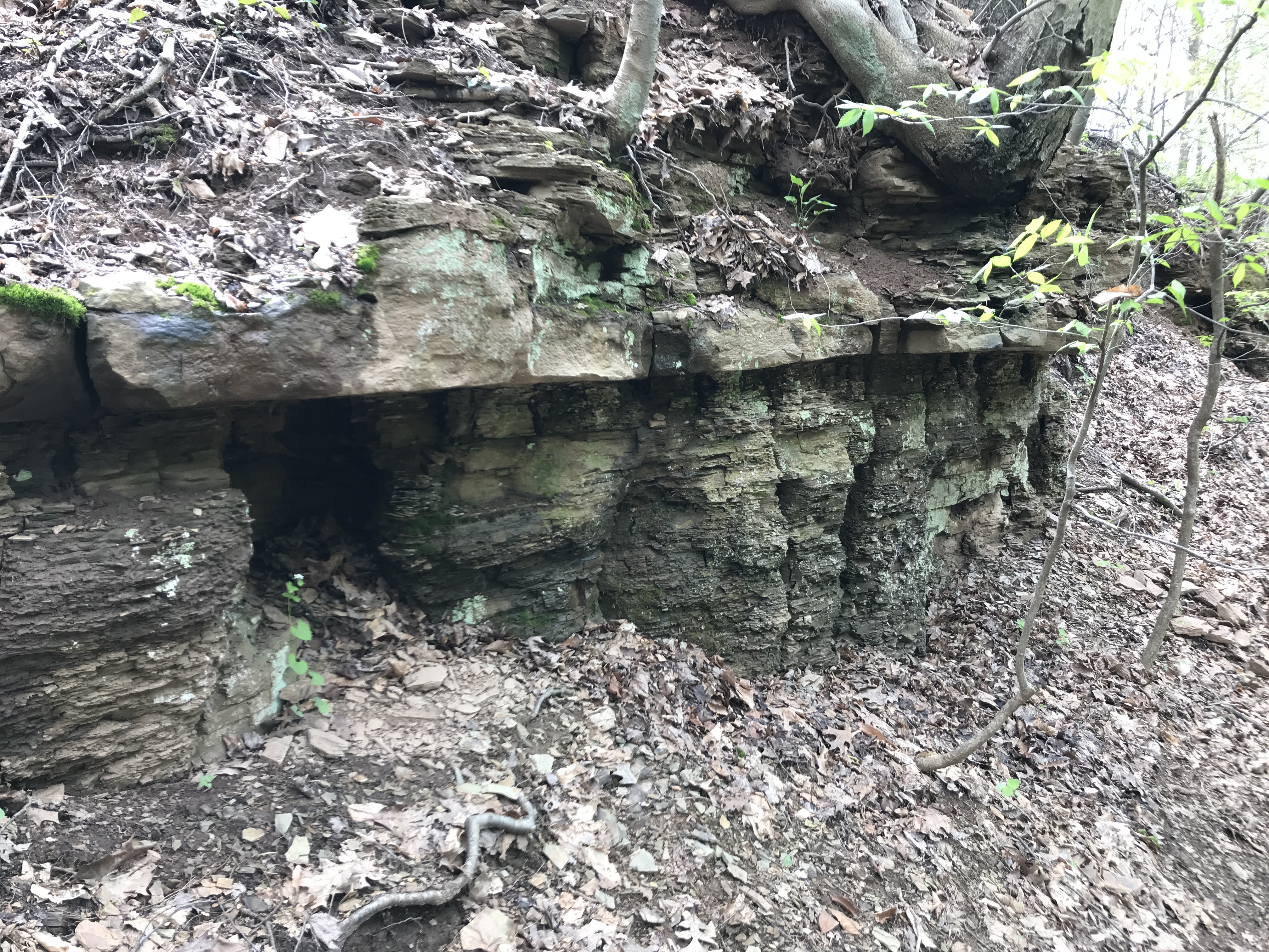
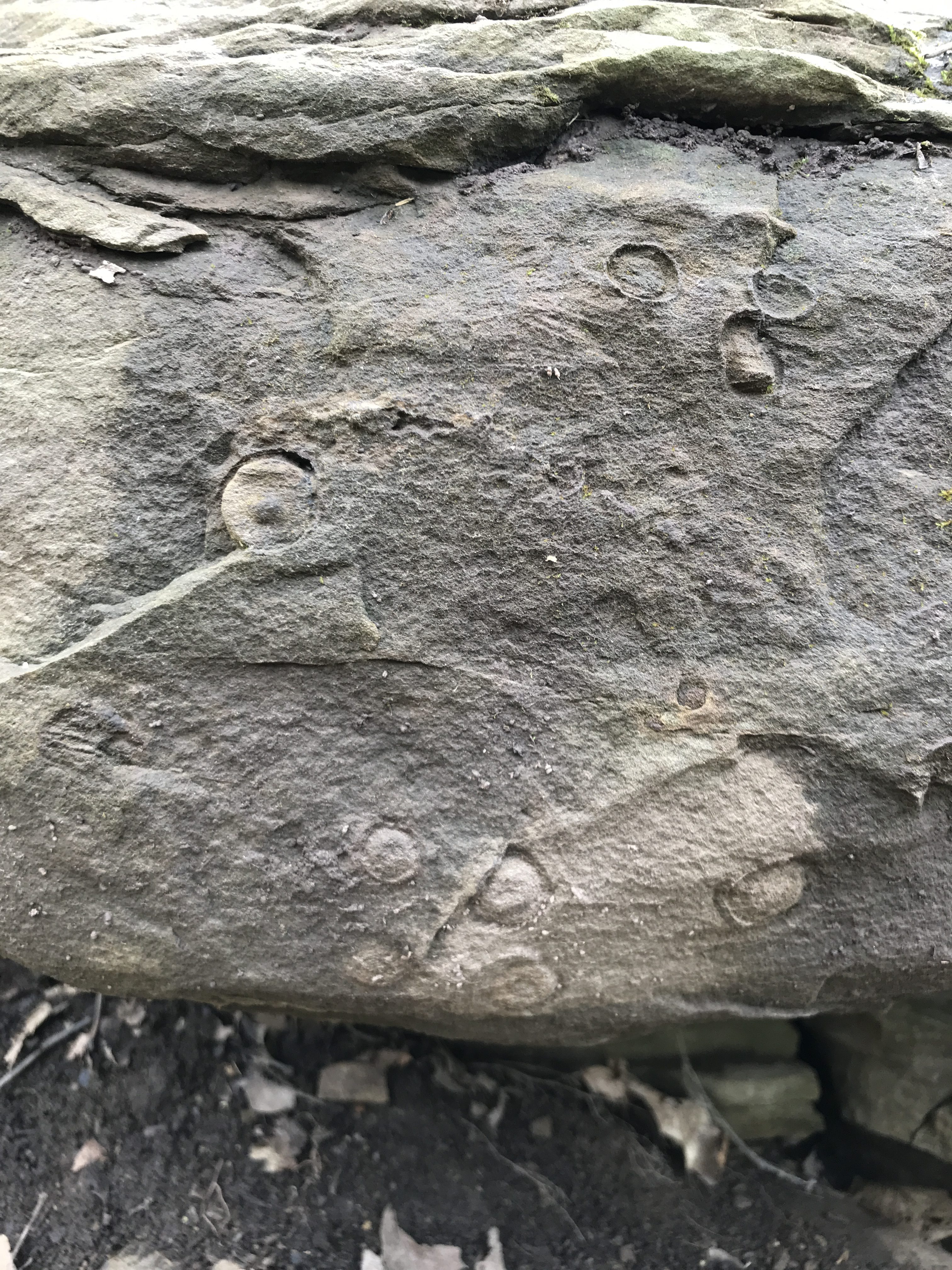
The first place I saw the limestone up close was in Frick Park. While there are several locations where I can find it, I have yet to find one with exposed rocks. I’ve done online searches for Ames Limestone and have often landed on the Sedimentation in Western Pennsylvania page, an old Pitt Geology web resource.
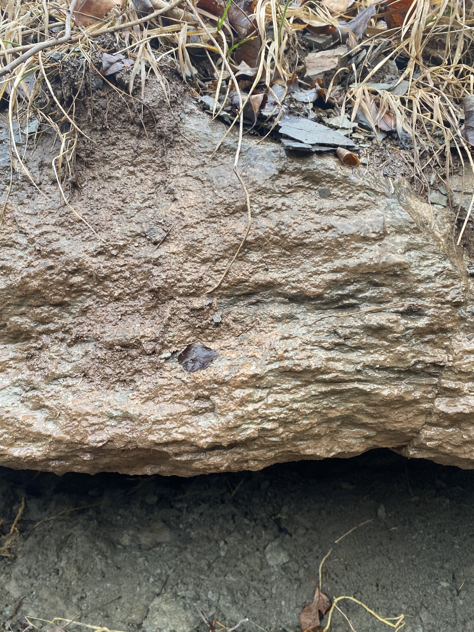
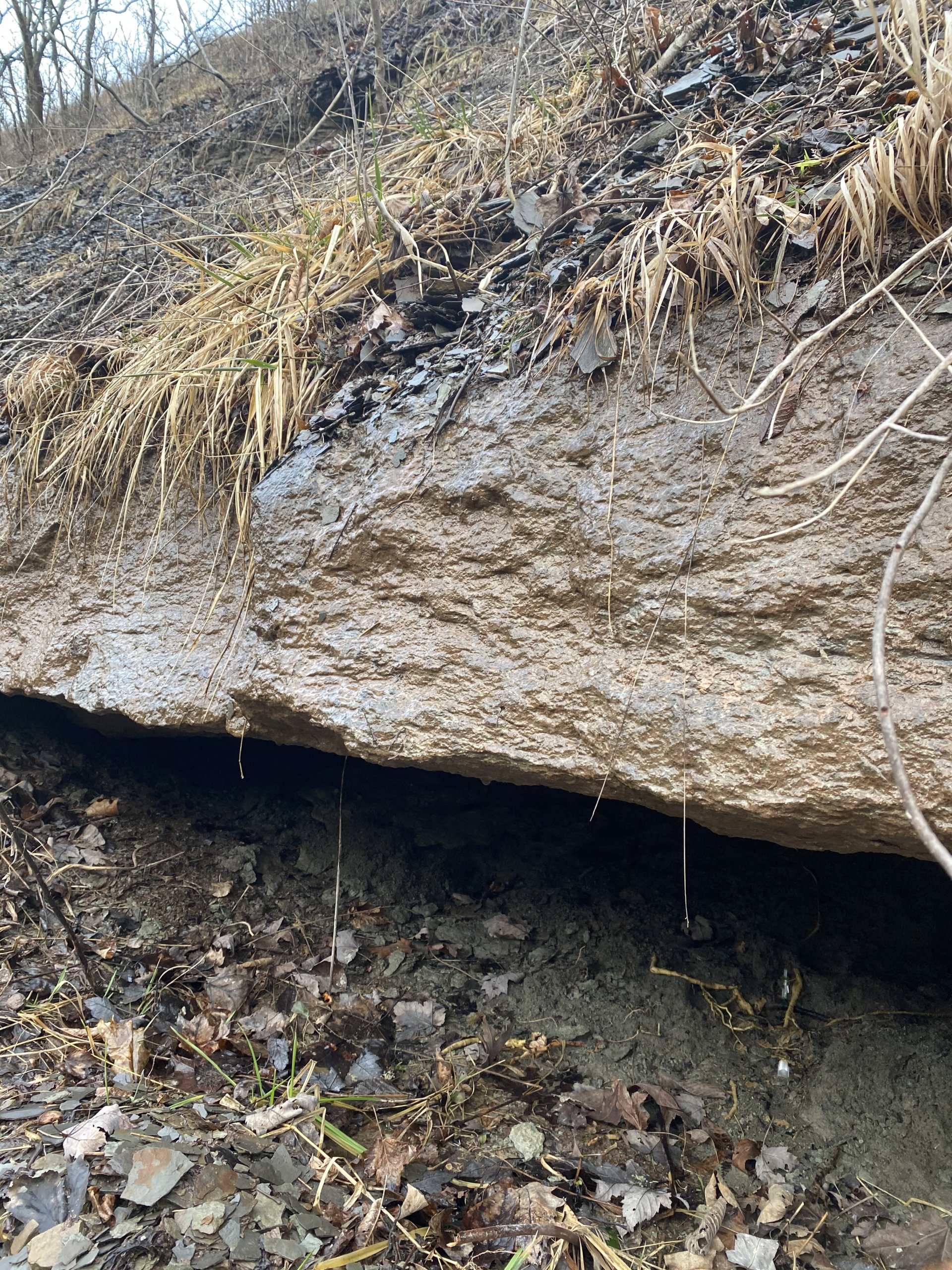
Following their directions, I quickly found two sets of outcrops. As mentioned, I could not find the hard ledge in the stream bed. However, there appears to be significant erosion in the stream bed, and several blocks of sandstone or limestone are present along the creek.
I did not bring a hammer or chisel. Quickly, I learned that you are not allowed to work on rocks in Frick Park. However, it was nice to finally see it up close.
The Ames Limestone in Northern Limits
In Penfield, PA, the farthest Northern mapped portion of the Ames exists a bit past DuBois, PA. This is over 60 miles from Parks Township.
While the Casselman layer may be eroded, it does not necessarily mean the Ames Limestone is gone. The stone remains long after the silty base layer has been eroded further. Float limestone can still be found in local streams after the more erodible layers have been washed away.
Ames Limestone along Route 28.
There are several places where the Ames crops out along Pennsylvania Route 28. During the road construction, massive amounts of the landscape were removed, exposing many hidden rocks. It can be seen more or less along stretches of the route from Etna to Tarentum.
More Information about the Ames
- Paleoenvironments of the Upper Pennsylvanian Ames Limestone and associated rocks near Pittsburgh, Pennsylvania – GeoScienceWorld [Subscription Required]
- Pennsylvania and Ohio Shape Files
References
- Andrews, E.B., 1873, Geology of Athens County, Chapter X, in Report of the Geological Survey of Ohio, Part I, Geology: Ohio Geological Survey, Report of Progress, 2nd series, v. 1, p. 261–293.
- Harper, J. A., 2016, Some geological considerations of the marine rocks of the Glenshaw Formation (Upper Pennsylvanian, Conemaugh Group), in Anthony, R., ed., Energy and environments: Geology in the “Nether World” of Indiana County, Pennsylvania. Guidebook, 81st Annual Field Conference of Pennsylvania Geologists, Indiana, PA, p. 47–62.
- Heckel, P.H., Barrick, J.E., and Rosscoe, S.J., 2011, Conodont-based correlation of marine units in lower Conemaugh Group (Late Pennsylvanian) in Northern Appalachian Basin: Stratigraphy, v. 8, p. 253–269.
- Hughes, H. H., (1936) – Topographic and Geologic Atlas of Pennsylvania No. 36 Freeport Quadrangle
- Perera, S.N., Stigall, A.L., 2018, Identifying hierarchical spatial patterns within paleocommunities: An example from the Upper Pennsylvanian Ames Limestone of the Appalachian Basin – Palaeogeography, Palaeoclimatology, Palaeoecology V. 506, p. 1–11
- White, I. C., 1878. Report of progress in the Beaver River district of the bituminous coal fields of western Pennsylvania. Middletown: Pennsylvania Geological Survey. 2nd Series, Report Q, 337 p.