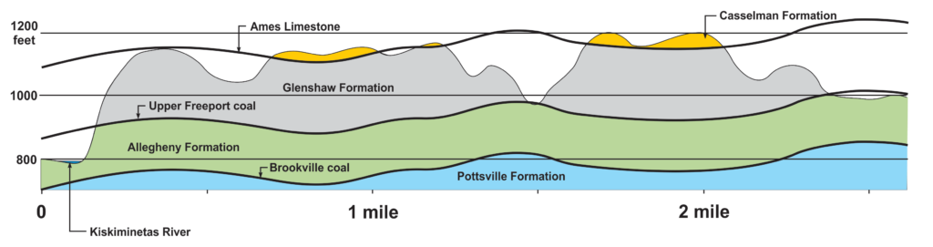
The Geology of Parks Township includes three named geologic formations inside the township’s boundaries. Most of the township is located within a geologic group called the Conemaugh. The Conemaugh Group consists of two unique formations. The Glenshaw, which is lower and older. And the Casselman, which is younger and higher. Parks Township rocks are all Pennsylvanian, mainly older than 300 million years of age. I am still performing further research to determine more accurate ages for locales.
My particular dig sites appear to be between 304 – 306 million years of age (Perera 2018). The rocks within Parks Township appear to be between 303 – 309 million years of age. The marine limestone where a majority of our specimens come from is the Brush Creek limestone. While elevation can be a good indicator of rock formations, you must consider local synclines and anticlines.

Synclines and Anticlines
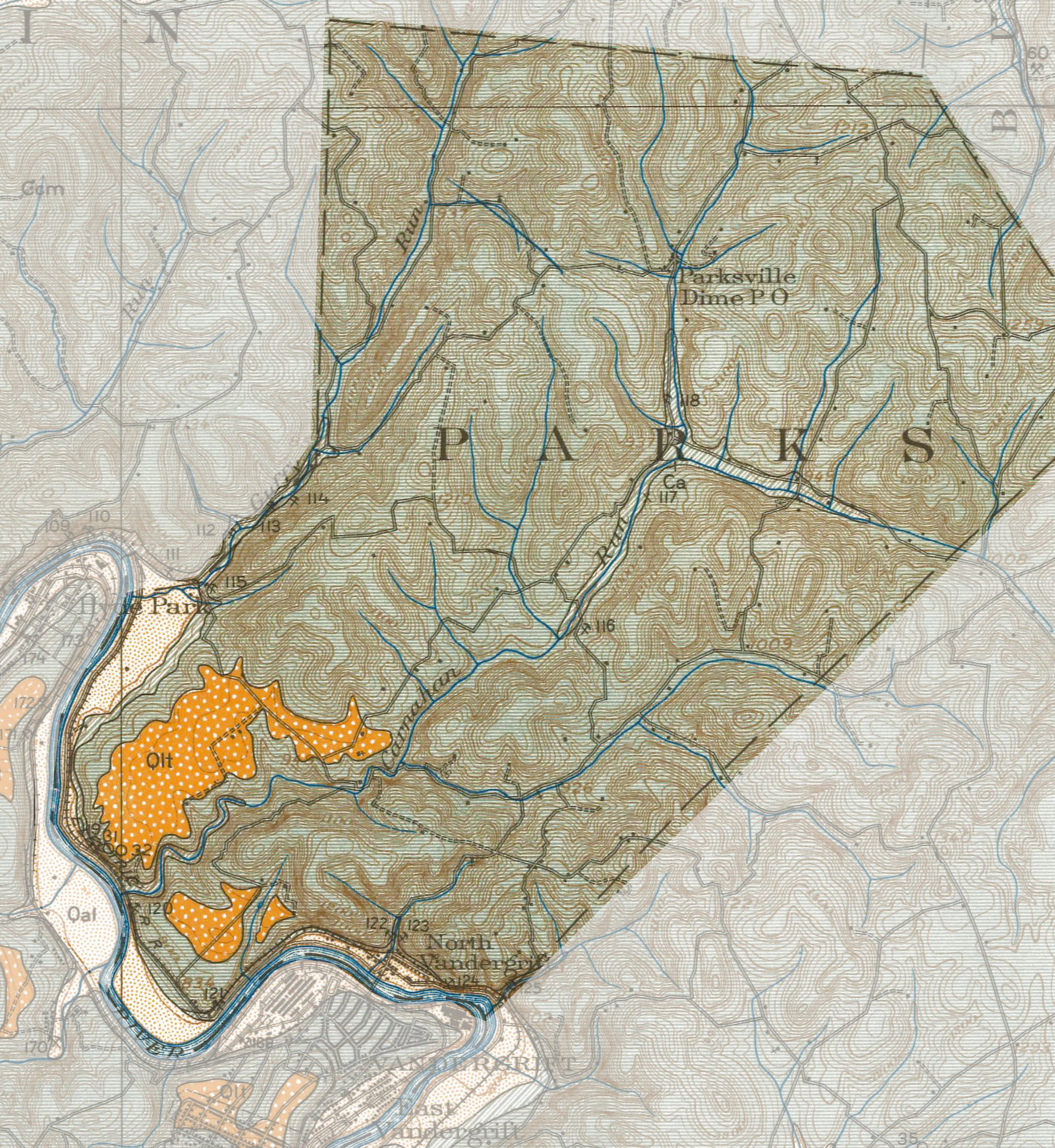
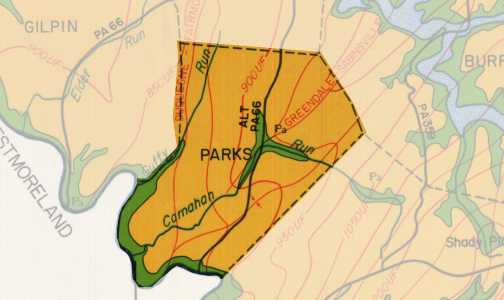
The Duquesne-Fairmount Syncline runs through Parks Township, starting at Kepple Hill in the South and generally follows north through Guffy Run. The Greendale-Sabinsville Anticline has a termination point in the center of the township boundaries.
On the surface, one can see hills or valleys over terrain. But, the formation geology below also rolls independently of what can be seen above the ground. For example, a syncline is a fold that has dropped in elevation, while an anticline is one that has risen. These broad dips and rises in the formations make using straight elevation difficult for figuring out formation later locations.
Parks Township Formation Geology
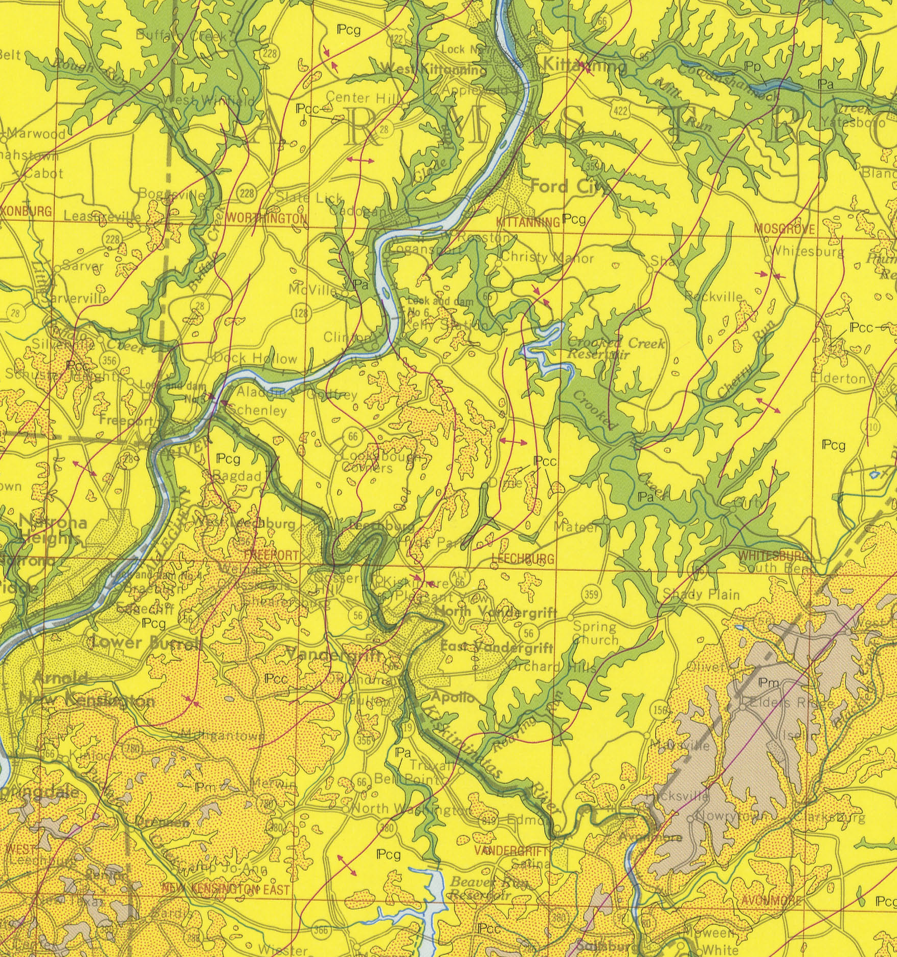
Authors have written much about local formations, the groups of rock layers that make up the bedrock. There are several correlations of layers over great distances. One such layer, The Ames Limestone, is shown on the map below; it can also be found here and in Ohio, West Virginia, Maryland, and Kentucky. It exists due to an overall geologic process: the flooding of the area that formed the Ames Sea.
by John A. Harper, 2019
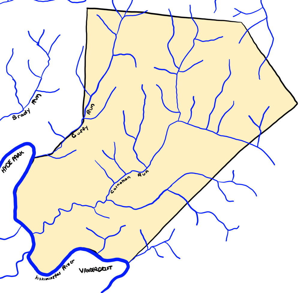
Water in Parks Township
There are two prominent water runs within the Township. The main run is Carnahan Run, which drains the Northern and Eastern portions of the township and empties at the Southern border into the Kiskiminetas River. Guffy Run borders the West.
Published Articles about Local Geology Formations
- Glenshaw Formation
- Ames Limestone
- Pine Creek limestone
- Brush Creek limestone
- Casselman Formation
- Allegheny Formation
- Parks Township Geology Formations
Pennsylvania 310 million years ago
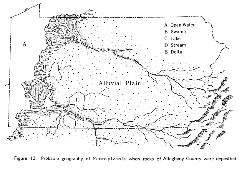
Copyright 1970 Pennsylvania Geological Survey
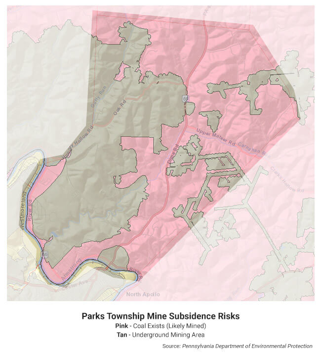
Mine Subsidence Risks
Since the Allegheny Formation sits at the base in Parks, the Upper Freeport Coal seam is readily mineable from the exposed hillsides. The 1800s, particularly after the Civil War and early 1900s, saw heavy local mining activity to extract this valuable resource. However, most, if not all, local mining has ceased operation in the present day. The map below shows the risks of coal mine subsidence within the township.
More Parks Township Geology Information
- Penn State University Libraries Digital Collections – Generalized geologic map of Armstrong County and locations of selected wells (1974)
More Reading About Paleogeography
- Paleomap Paleoatlas – EarthByte Group
- 250 Ma until the present, tectonic reconstruction – EarthByte on YouTube
- Ancient Earth Globe – Dinosaur Database
References
- T.M. Berg, M.K. McInerney, J.H. Way, D.B. MacLachlan (1983) – Stratigraphic Correlation Chart of Pennsylvania
- Wagner, W. R.; Heyman, L.; Gray, R. E.; Belz, D. J.; Lund, R.; Cate, A. S.; and Edgerton, C. D. (1970) – Geology of the Pittsburgh Area, General Geology Report G 59, Pennsylvania Geological Survey, Fourth Series, Harrisburg, PA, 1970
- Perera, S. N.; Stigall, A.L. (2018) – Identifying hierarchical spatial patterns within paleocommunities: An example from the Upper Pennsylvanian Ames Limestone of the Appalachian Basin
- Mine Subsidence Insurance – PA DEP
- Mine Subsidence Risk Map – PA DEP