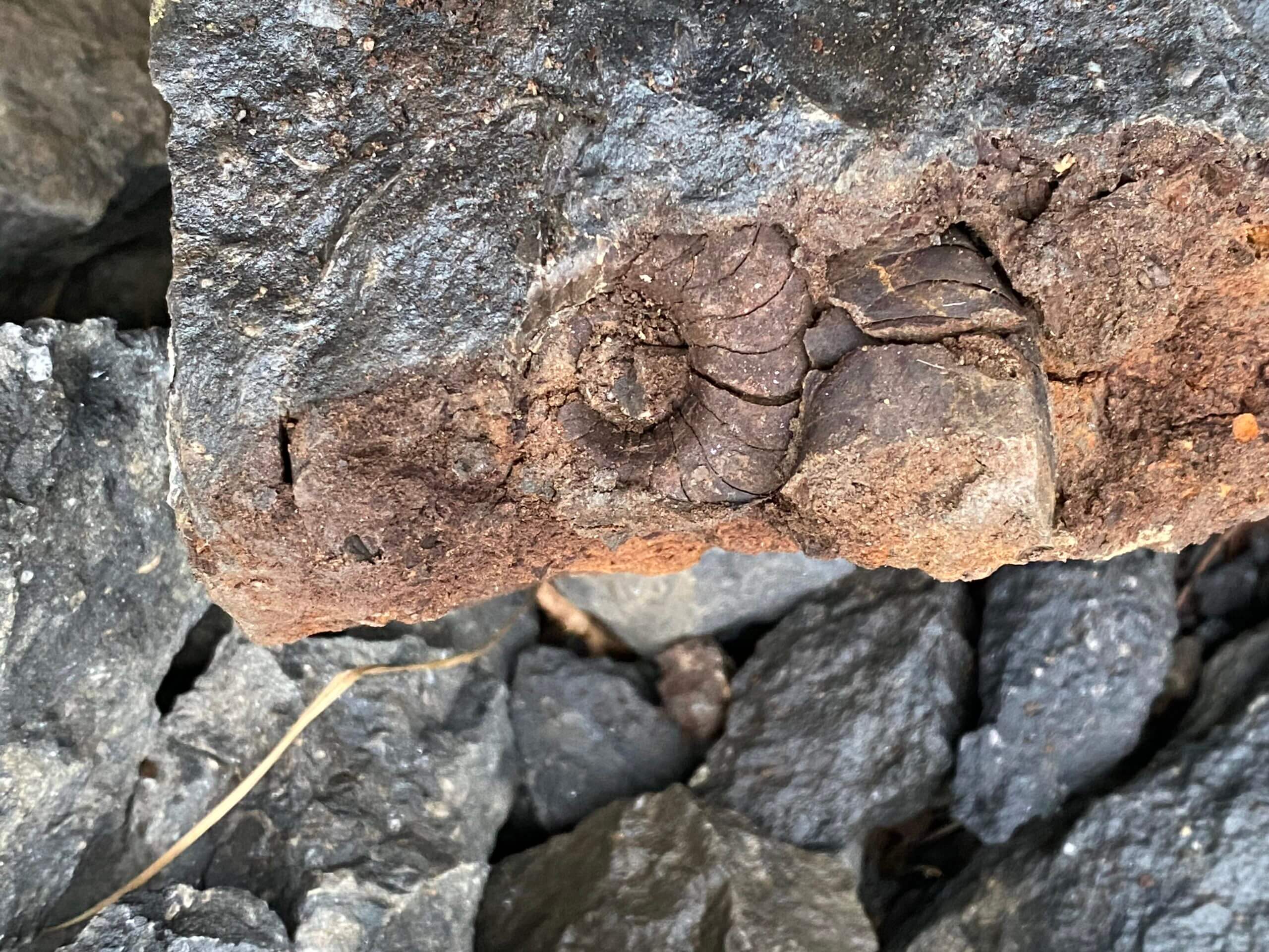
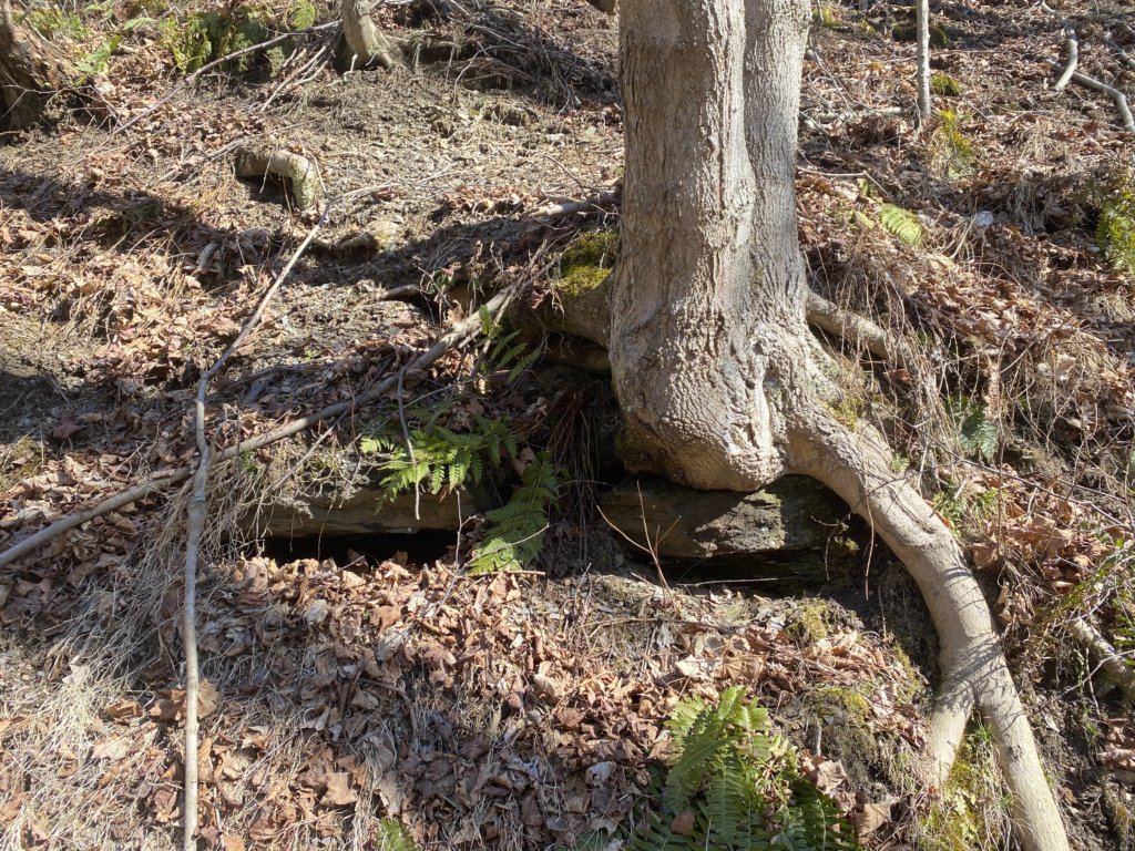
The Brush Creek limestone is one of four primarily laterally extensive fossiliferous limestone strata within the Glenshaw Formation of the Middle to Upper Pennsylvanian age Conemaugh Group. It is named for outcrops along Brush Creek in Cranberry Township, which is neighboring Butler County. The limestone is very dark in appearance, being a dark gray rock.
Locally, 100 percent of all limestone fossils we collect likely come from Brush Creek material. There are neighboring limestones in the stratigraphic layers, such as the Pine Creek and Woods Run limestones. These can be mistaken for Brush Creek (or vice versa) and have been many times in the recent past in Western Pennsylvania. I am still not 100 percent sure I am looking at Brush Creek, but I don’t have any evidence against it yet. Hughes (1933) states that the Upper Freeport coal sits 120 feet below the Brush Creek limestone. Also, stratigraphic sections from cores taken in Parks Township indicate that the Brush Creek coal, which is stratigraphically lower than the limestone, is consistently about 150 feet above the Upper Freeport.
What is Limestone?
Of the significant sedimentary rock types, shale, sandstone, and limestone are the three most prolific types. Shales form when tiny bits of sediment, 1/256 mm in size or smaller (mud and silt), become deposited by wind, water, or ice. Sandstones form in much the same way, except that they consist of much larger pieces of sediment, 1/16 – 2 mm in size.
Marine limestones such the Brush Creek or the Pine Creek form in clear, shallow, warm seas. These rocks are made of at least 50% calcium carbonate (CaCO3), a mineral that precipitates from the water or accumulates from the shells of dead plants and animals. This mineral is in the form of either calcite or aragonite, which forms shells. Aragonite has a different crystal structure than calcite and is less stable. Over time, calcite replaces the aragonite structures and features of the fossilized fauna within. It creates a crystal pattern in some fossil specimens I find, often with discernable cleavage planes.
Where did Brush Creek Limestone Come From?
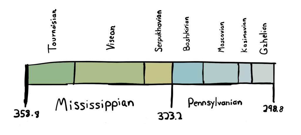
Most local rocks were deposited at or around 304 million years of age. This was a time when sea levels would often rise and fall, at times flooding the area. These are known as glacial-eustatic fluctuations in sea level. Global warming and cooling that occurred during this time caused ice to melt or form. This increased or decreased the eustatic sea level, which is a measurement of the height of the sea from the center of the Earth (Patzkowsky & Holland 2012).
Western Pennsylvania is known to have been south of the equator then, meaning that the water was warm, possibly shallow, and clear. These conditions happened more than once because there are several laterally extensive marine limestone layers in the area. The Pine Creek and the Ames marine zones are two more examples of times when water extensively flooded the region.
However, these were not quick flooding events. Throughout tens to hundreds of thousands of years, the water would come in, stay for a while, and eventually leave. The world in the Carboniferous was much different, with a year lasting around 385 days and a day itself only 22.4 hours (Wells 1966). Fossil corals were used to determine this. These corals have a microscopic growth layer that accumulates daily throughout the year. Scientists counted these layers from fossil specimens and were able to provide estimates for the length of the year (Wells 1966).
How Do We Know The Ages?
Sedimentary rock is tough to date. Since it is made up of numerous pieces of other stones all rearranged, getting an accurate date is tricky. Furthermore, you can only get exact dates from certain kinds of rock. Nevertheless, the fundamental rules in geologic stratigraphy are often correct. One of them, the Principle of Superposition, states that layers of bedrock are arranged by age. The higher layers are positioned, the younger their age. However, there are some very unusual examples on Earth where entire rock groups are upside down, some distorted by 90 or even 180 degrees.
The radioactive isotope potassium-40 (40K) is common in igneous rocks. It decays at a specific rate to form argon-40 (40Ar) and this can be measured when dating igneous rocks (K-Ar dating). Since 50 percent of the potassium-40 will have turned into argon-40 in approximately 1.2 billion years, scientists can calculate the age of these rocks. This is helpful if a volcano has deposited rocks in a layer near the sedimentary rock you want to date.
However, this doesn’t help us here in this area of Pennsylvania. While there are igneous rocks in the state, there do not appear to have been any volcanoes depositing rocks in the local layer adjacent to the Brush Creek limestone. There is a possible layer of volcanic ash in the Glenshaw Formation, but it has not yet been adequately researched.
Ways to Correlate Sedimentary Strata
Using fossil evidence is another way to correlate rock strata over long distances. For example, the Brush Creek and Pine Creek limestones are similar to the casual observer. Therefore, many have attempted to identify and connect these layers by fossil species using macrofossils. And although it can be a very successful process in some instances, the Brush Creek and Pine Creek macrofossils generally are so similar as to be useless for correlation. For example, there have been no examples of the genus Tainoceras recovered below the Ames and Woods Run Limestone. However, to correctly correlate a particular stratum using macrofossils, it’s best to use a series of specific species.
There is where conodonts come in. These microscopic fossil oral elements that resemble teeth from extinct eel-like vertebrates are beneficial for identifying and correlating sedimentary layers. Because they also evolved into different species quickly, the conodonts components in the rock changed rapidly. As a result, different conodonts can be found in each marine limestone in western Pennsylvania, allowing scientists to correlate the local rocks with those throughout North America.
| Limestone | Conodont Species |
|---|---|
| Ames | ldiognathodus simulator |
| Woods Run | Streptognathodus gracilis |
| Nadine | Streptognathodus gracilis |
| Pine Creek | ldiognathodus confragus |
| Brush Creek | ldiognathodus cancellosus |
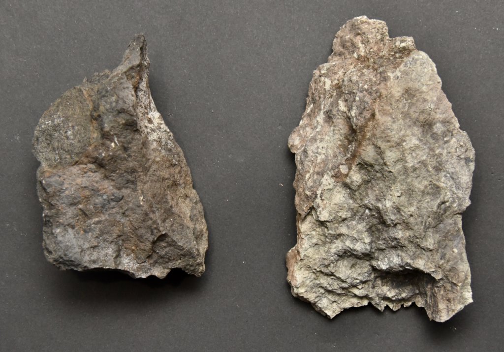
Examples of Brush Creek limestone
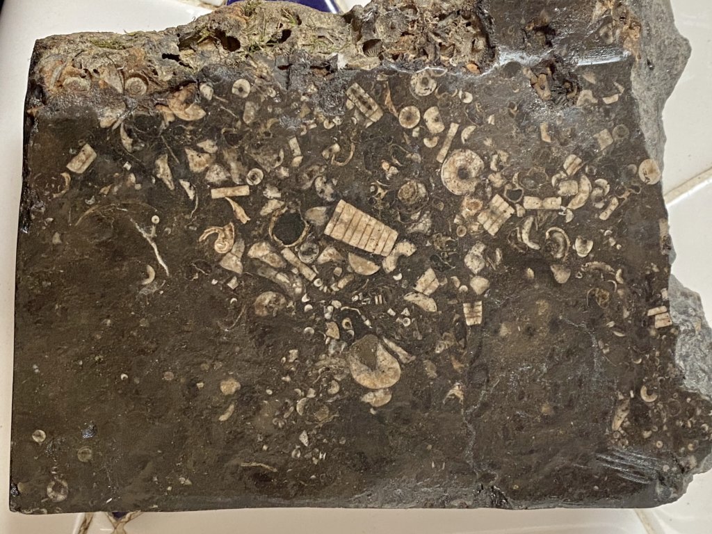
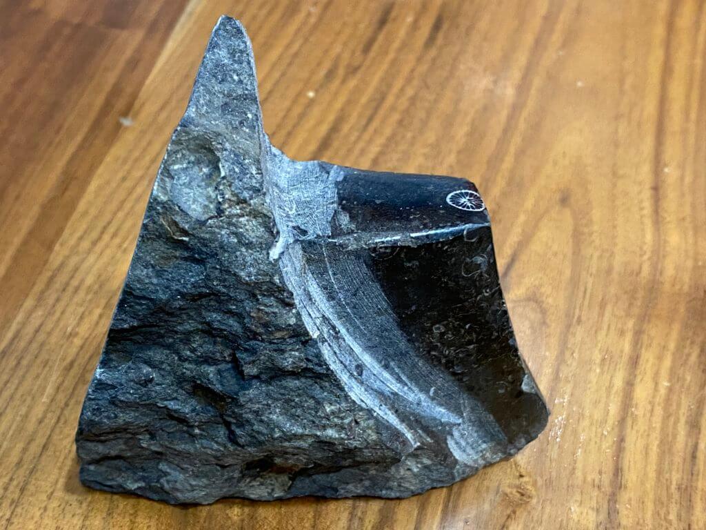
Brush Creek Limestone Compared to the Ames Limestone
The Ames Limestone is a younger limestone than the Brush Creek, with a separation of approximately 2.3 million years between the two ancient seas. The Ames has a much lighter matrix, likely due to a less anoxic environment when the sea invaded the land. As the marine creatures died, they settled on the bottom of the sea. More oxygen in the water decomposes their organic parts quickly via oxidation.
Interestingly, the cephalopod Tainoceras can be found in the Ames Limestone but is absent from the Brush Creek limestone.
Acknowledgments
I want to extend thanks to John A. Harper for giving me a peer-review of this article and for educating me about western Pennsylvania geology.
References
- Busch, R. M., and Rollins, H. B., 1984, Correlation of Carboniferous strata using a hierarchy of transgressive–regressive units: Geology, v. 12, p. 471-474.
- Harper, J. A., 2016, Some geological considerations of the marine rocks of the Glenshaw Formation (Upper Pennsylvanian, Conemaugh Group), in Anthony, R., ed., Energy and environments: Geology in the “Nether World” of Indiana County, Pennsylvania. Guidebook, 81st Annual Field Conference of Pennsylvania Geologists, Indiana, PA, p. 47-62.
- Heckel, P. H., Barrick, J.E., and Rosscoe, S.J., 2011, Conodont-based correlation of marine units in lower Conemaugh Group (Late Pennsylvanian) in Northern Appalachian Basin: Stratigraphy, v. 8, p. 253-269.
- Hughes, H. H., 1933, Topographic and Geologic Atlas of Pennsylvania No. 36 Freeport quadrangle, Pennsylvania Geological Survey 4th, Atlas 36, 272 p.
- Patzkowsky, M. E., Holland, S. M. (2012), Stratigraphic Paleobiology. Chicago: University of Chicago University Press. p. 30
- Perera, S. N., Stigall, A.L., 2018, Identifying hierarchical spatial patterns within paleocommunities: An example from the Upper Pennsylvanian Ames Limestone of the Appalachian Basin – Palaeogeography, Palaeoclimatology, Palaeoecology V. 506, p. 1-11
- Wells, J. W., 1966, Paleontological evidence of the rate of the Earth’s rotation. pp. 70-81, in: B. G. Marsden and A. G. W. Cameron (eds.), The Earth-Moon System, Springer.
- White, I. C., 1878. Report of progress in the Beaver River district of the bituminous coal fields of western Pennsylvania. Middletown: Pennsylvania Geological Survey. 2nd Series, Report Q, 337 p.

